VolksNav in Karslruhe
Klicke einen Punkt auf der Karte an und erfahre die dazugehörige indoor oder urbane Leitzahl
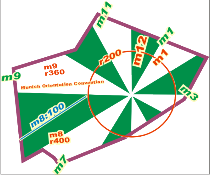
Urbane Leitzahlen wie z. B.
| Schloss Gottesaue m4 r20 | Zukunftraum m3:2 r18 |
bestehen aus Stunden, Minuten und Radius gemäss folgender Konvention:
| StatusQuo Karlsruhe | Vorspann einer logischen Positionsangabe | Der urbane Pol ist das Schloss |
| m12 | Referenz-Horizontstunde | Richtung vom Pol nach Norden, m3 nach Sonnenaufgang etc. |
| Zahl nach Doppelpunkt | Horizontminuten | Entfernung zur Horizontstunde, 1 Einheit = 100 Meter Die blauen Linien zeigen :50 Minuten |
| r... | Radius |
Entfernung zum Pol, |
Diese Karte konvertiert Geokoordinaten zu StatusQuo mit einer vereinfachten Methode, annehmbar bis etwa 10 km. Für professionelle Konvertierungen siehe VolksNav.com/mapplet
Die Methode erlaubt auch die Bildung von Quartierleitzahlen und Quartier-Logos, z. B. Beispiel::
 |
Oststadt Karlsruhe m3 r16. 1 Einheit = 100 Meter An der Biegung von r16 erkennt man sofort wo die Stadtmitte ist und dass die Oststadt sich in den Sektoren m12 bis an m4 befindet. |
Es lassen sich auch Liniencodes und Linienlogos bilden, z. B. Linie 4
Linie m7 nach m1 bzw. m1 nach m7
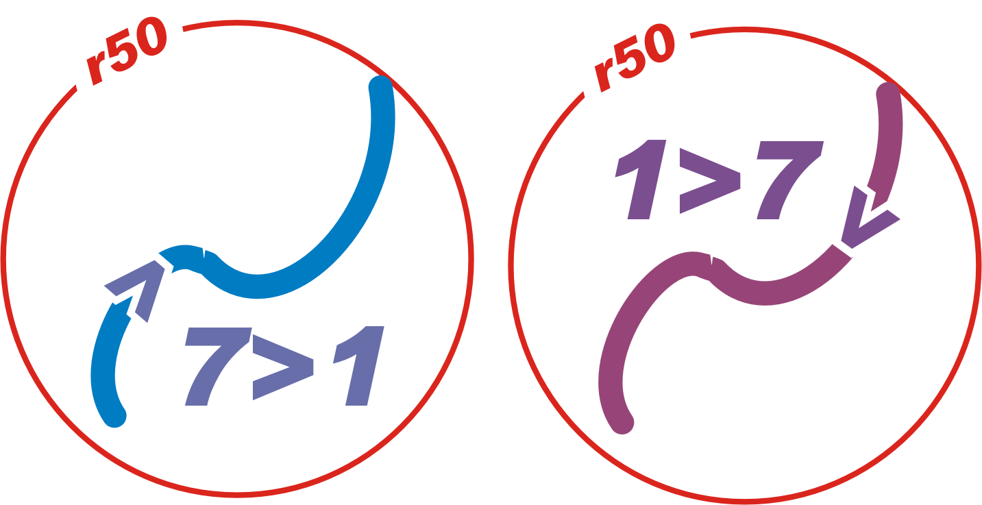 sprich "Linie sieben eins" bzw. "1 7"
| Name | Zeit/Raum | Radius |
|---|---|---|
| Badeniapl. | m7:5 | r44 |
| Wilhelm Leuschner | m7:8 | r44 |
| Oberreut Zentrum | m7:11 | r44 |
| Albert Braun Str. | m7:12 | r41 |
| Hardecksiedlung | m7:11 | r35 |
| Bannwald Allee | m7:10 | r31 |
| Europahaus | m7:9 | r26 |
| Landesbausparkasse | m7:10 | r24 |
| Winbrennerpl. | m8:2 | r22 |
| Sophienstr. | m8:3 | r20 |
| Schillerstr. | m8:5 | r18 |
| Mühlburger Tor | m8:4 | r16 |
| Europapl. Postgalerie | m7:3 | r9 |
| Karlstor | m7:1 | r12 |
| Ettlinger Tor | m6:1 | r9 |
| -------------------------east-west transition | ||
| Ruppurer Tor | m5:1 | r10 |
| Durlacher Tor | m3:5 | r11 |
| Karl-Wilhelm-Patz | m3:3 | r14 |
| Hauptfriedhof | m3 | r17 |
| ------------------------ north-south transition | ||
| Hirtenweg | m2:9 | r26 |
| Sinsheimer Str. | m2:8 | r30 |
| Fächerbad | m2:5 | r34 |
| Eichbäumle | m2:1 | r36 |
| Gloggauerstr. | m1:14 | r34 |
| Waldstadt | m1:14 | r38 |
| Jägerhaus | m1:14 | r41 |
| Elbingerstr. | m1:14 | r45 |
| Osteroder Str. | m1:11 | r45 |
| Europäische Schule | m1:10 | r47 |
Dieselbe Methode kann auch global oder indoor eingesetzt werden.
Beispiel Hauptfriedhof, Variante mit kleine Kapelle-Zentrierung
 1 Einheit = 1 Meter
-----
Evolution