VolksNav in Regensburg
Klicke einen Punkt auf der Karte an und erfahre die dazugehörige indoor oder urbane Leitzahl
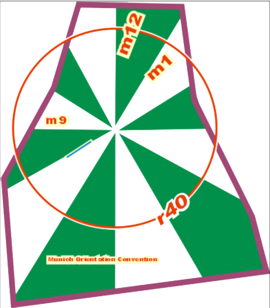
Urbane Leitzahlen wie z. B.
| Frankenbrücke | Regensburg m12:4 r10 |
| Der Denninger | Regensburg m8 r1 |
bestehen aus Stunden, Minuten und Radius gemäss folgender Konvention:
| StatusQuo Regensburg | Vorspann einer logischen Positionsangabe | Der urbane Pol ist der Dom |
| m12 | Referenz-Horizontstunde | Richtung vom Pol nach Norden, m3 nach Sonnenaufgang etc. |
| Zahl nach Doppelpunkt | Horizontminuten | Entfernung zur Horizontstunde, 1 Einheit = 100 Meter Die blauen Linien zeigen :50 Minuten |
| r... | Radius |
Entfernung zum Pol, 1 Einheit = 100m. Der rote Kreis zeigt r100 = 10km. |
Diese Karte konvertiert Geokoordinaten zu StatusQuo mit einer vereinfachten Methode, annehmbar bis etwa 10 km. Für professionelle Konvertierungen siehe VolksNav.com/mapplet
12 Himmelsrichtungen können auch global oder indoor eingesetzt werden, z. B. Uni Regensburg:
 1 Einheit = 10 Meter
Damit lassen sich Gebäude, Kreuzungen, Kunstobjekte etc. kinderlogisch adressieren.
Die Raumnummerierung kann nach der selben Methode erfolgen und damit auch Evakuierungen mittels Lautsprechern, Megaphonen oder smarphones ermöglichen.
Imaginäre Uhren lassen sich in Logos einbauen:
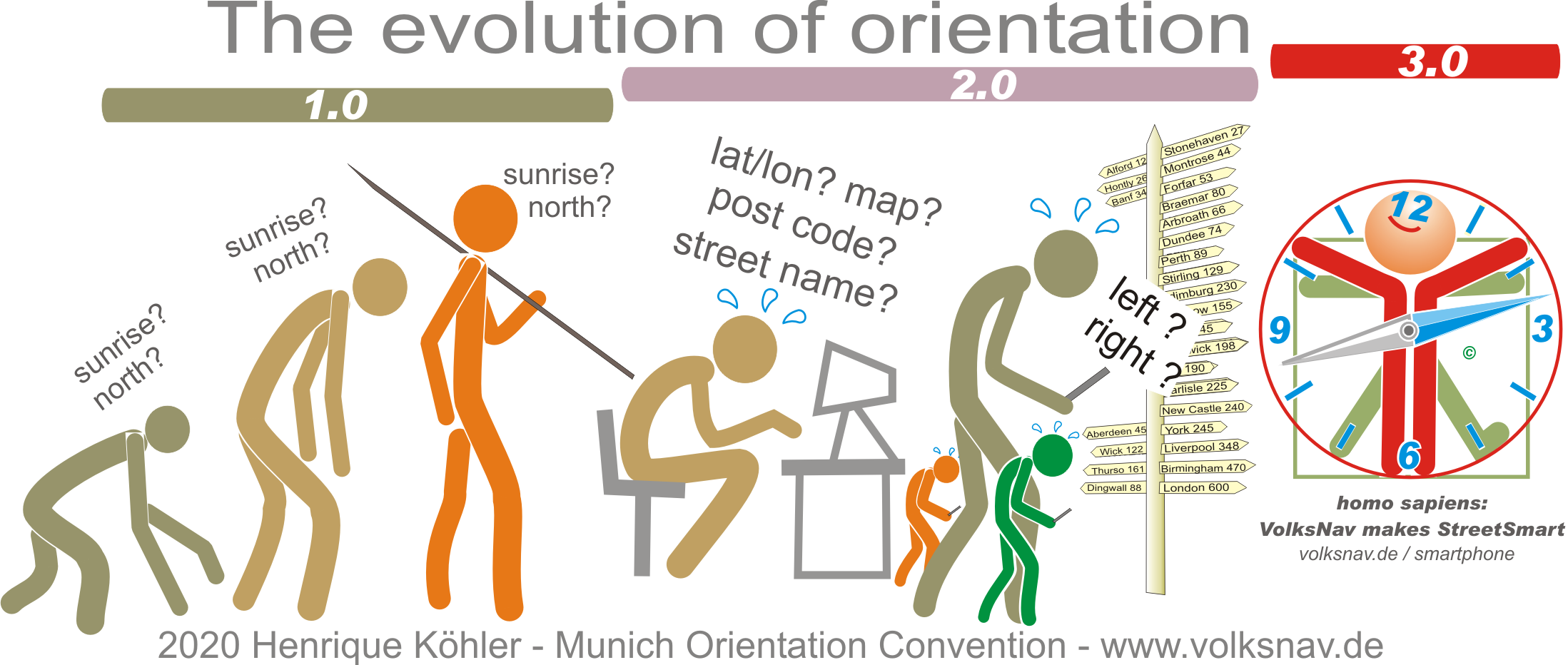
Es ergibt sich eine Evolution: