VolksNav in Singapore
Click or doubleClick a point on map to know the logical area code of that point
Area codes consist of hours, minutes and radius according to following convention:
| element | meaning | details |
|---|---|---|
| StatusQuo Singapore | prefix of an urban position code | The urban pole is the Orchard |
| m12 | reference horizon hour |
from urban pole to north, m3 to sunrise, m6 to south etc. |
| number after ":", e.g. m12:5 | horizon minutes, blue lines |
distance to horizon hour,
|
r..., e. g. r66 |
radius, red lines |
distance to urban pole, 1 unity = 100m |
This map converts lat/lon to StatusQuo on a simplified mode, tolerable for radius < 10 km. For a professional conversion, see VolksNav.com/mapplet
--------
The division of the horizon into 12 directions can also be used global or indoor.
Example Orchard station, smart addressing of exits, shops etc.
 (in interactive map integrated)
This method also allows to define codes for stations and lines but also line pictograms, for example Thomson East Coast line
| line | m11 to m4 | m4 to m11 |
 say "line eleven four" or "line 4 11
| station name | time/space | radius |
|---|---|---|
| Woodlands North | m11:36 | r168 |
| Woodlands | m11:31 | r155 |
| Woodlands South | m11:32 | r143 |
| Springleaf | m11:37 | r105 |
| Lentor | m12:5 | r90 |
| Mayflower | m12:5 | r76 |
| Bright Hill | m12 | r66 |
| upper Thomson | m12 | r56 |
| Caldecott | m12:7 | r38 |
| Mount Pleasant | m12:3 | r28 |
| Stevens | m11:2 | r20 |
| Orchard blv. | m9 | r11 |
| ------------------- transition N / S / E / W | ||
| Orchard | r0 | |
| Great World | m5:4 | r10 |
| Havelock | m5:8 | r17 |
| Outram Park | m5:6 | r27 |
| Maxwell | m5:2 | r29 |
| Shenton Way | m4:15 | r35 |
| Marina Bay | m4:15 | r40 |
| Marina South | m4:12 | r47 |
| Gardens by the bay | m4:4 | r48 |
Circle line.
| direction | clockwise = r+ | counter clockwise = r_minus: |

| name | time/space | radius |
|---|---|---|
| Dhoby Ghoat | m3:5 | r15 |
| Bras Basah | m3:7 | r21 |
| Esplanade | m3:11 | r28 |
| Promenade | m3:12 | r34 |
| Nicolle Highway | m3:4 | r35 |
| Stadium | m3:1 | r47 |
| ----------------- transition N / S | ||
| Mountbatten | m2:25 | r56 |
| Dakota | m2:26 | r62 |
| Paya Lebar | m2:20 | r68 |
| MacPherson | m2:10 | r69 |
| Tai Seng | m2 | r71 |
| Bartley | m1:24 | r68 |
| Serangoon | m1:13 | r68 |
| Lorong Chuan | m1:4 | r64 |
| Bishan | m12:17 | r55 |
| Marymount | m12:7 | r51 |
| Caldecott | m12:7 | r38 |
| ------------------- transition E / W | ||
| Botanic Gardens | m10:8 | r29 |
| Farrer road | m10 | r32 |
| Holland Village | m9:9 | r42 |
| Buona Vista | m9:3 | r46 |
| ------------------ transition N / S | ||
| one north | m8:21 | r51 |
| Kent ridge | m8:17 | r55 |
| Haw Par Villa | m8:8 | r61 |
| Pasir Panjang | m7:24 | r55 |
| Labrador Park | m7:11 | r48 |
| Telok Blangah | m7:4 | r45 |
| Harbor Front | m6:12 | r44 |
| ----------------------- transition E / W | ||
| Bay Front | m4:5 | r38 |
| Marina Bay | m4:15 | r40 |
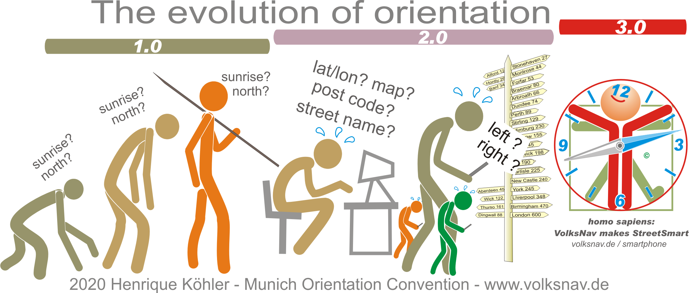
------------
Evolution