VolksNav in Brussels
Click or doubleClick a point on map to know the logical indoor or area code of that point
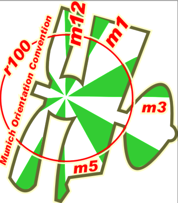
Area codes like "airport m1:50 r107" consist of hours, minutes and radius according to following convention:
| element | meaning | details |
|---|---|---|
| StatusQuo Brussels | prefix of an urban position code | The urban pole is the Grote Markt |
| m12 | reference horizon hour |
from urban pole to north, m3 to sunrise, m6 to south etc. |
| number after ":", e.g. m12:5 | horizon minutes, blue lines |
distance to horizon hour,
|
r..., e. g. r66 |
radius, red lines |
distance to urban pole, 1 unity = 100m |
This map converts lat/lon to StatusQuo on a simplified mode, tolerable for radius < 10 km. For a professional conversion, see VolksNav.com/mapplet
--------
The division of the horizon into 12 directions can also be used global or indoor.
example European Commission Brussels m3:3 r21
 1 unity = 1 meter
European Parliament Brussels m4 r19
--------------------
Codes for stop points and lines / line pictograms
Line r15+ and r15-, shown on interactive map

| name | time-space minutes | radius |
|---|---|---|
| Simonis | m10:8 | r24 |
| Ribaucourt | m11 | r18 |
| ----------------- W / E transition | ||
| Yser | m12 | r11 |
| Rogier | m12:4 | r10 |
| Botanique | m1:4 | r12 |
| Madou | m2:2 | r12 |
| ---------------- N / S transition | ||
| Arts-Loi | m3:1 | r12 |
| Trone | m4 | r11 |
| Naamsepoort | m4:5 | r11 |
| Louise | m5:5 | r13 |
| --------------------- E / W transition | ||
| Munthof | m6:2 | r15 |
| porte de Hai | m6:7 | r17 |
| gare du Midi | m7:3 | r15 |
| Clemenceau | m8:2 | r16 |
-----
Signage on crossings, including north and center pointers
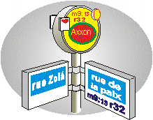 |
Convention: f12 = in front of you North is left hand (f10), City Center is ahead and right side (f1) |
------------
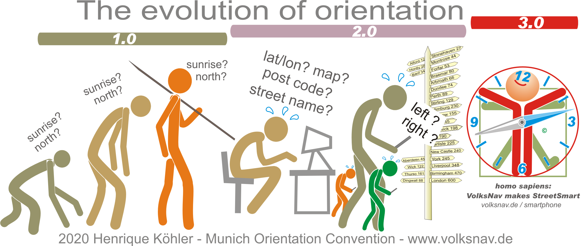
Evolution